Project Results:
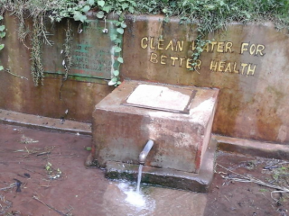
With assistance of VIA Water UPANDE completed the building of its IT-approach towards Non-Revenue-Water reduction. The pilot focused on piloting economic sensors in combination with economic communication through LoRa (Low Radition Radio waves). The project combined the set-up at the office in Nairobi and in Kericho to build and test prototypes, whereafter the concept was successfully tested in 3 other utilities such as in Naivasha. The project was called WaSHMis and the built applications got the name ViPiMo. The partnership worked well with Kewasco (Kericho) and Springuin, but one of the other partners (Brck*) was attracted by other business opportunities.
Main challenge is that Utilities need to be convinced to sign contracts for this kind of services, as they prefer to wait for new financial deals (such as partial grants) to get free access to such services. The contract got some up-topping, which was partly used for capacity building of Upande to build on their business concepts.
Key results
- Utilities are now able to get (almost) real time data that are used to find leakages and other irregularities.
- Kericho town reached a lot of savings by reducing the pressures at night.
- One other utility was able to raise revenues by more than 100%.
- The system has also other applications, such as in the flower trade.
Tips for the future
- To convince utilities to invest in structural IT-changes instead of hopping from one to the other free opportunity
Potential for growth
The model has shown high potential for the reduction of Non-Revenue Water and increase of revenues for Utilities. As such, the system has become one of the key business lines within Upande.
Project partners
UPANDE Ltd, Kewasco and Springuin
Period
May 2016 - March 2019
Location
Nairobi, KenyaKericho, Kenya
Last project updates
Background
Upande has been working on the development of its WaSHGIS framework with live sensor data integration since 2012. This work stems from Upande’s findings that off the shelf SCADA like data logging solutions are often too expensive and therefore out of reach for many WSPs, unless through donor funding. Moreover, the actual flow measuring sensors are also rather expensive, all the more so because each of them need to be physically connected to a data logger. This means implementation costs become prohibitive for even pilot projects, let alone upscaling by WSPs.
Besides the still relatively expensive sensor/logger combinations as tested by Upande since 2012, prevailing physical conditions of prioritized locations have proved challenging during the WaSGHIS project phases. Master meters are sometimes located along a simple track, unprotected, easily trampled upon by humans/livestock and prone to theft and vandalism.
Project Plan
The project will kick off with a Rapid Prototyping phase in which lab based prototypes will be built for a wide range of representative sensors (flow, pressure, level, plus several sensors relevant for agriculture, environment), gateways and database backends. Full functionality for accurate data collection and dissemination will be built, though not yet optimized for rugged field situations and ease of use. Prototype results will be reported at the end of the inception phase, preparing for full project go ahead.
Upon full project go-ahead, the Design Phase will be entered in which both hardware and software will be functionally and technically drawn up using agile processes and iteration cycles. Actual end users of the various products will be consulted in these processes so as to ensure what is being developed is what they are looking to get at the end of the development cycle.
Early versions of the hardware and software developed will be Field Tested throughout in order to ensure that they will function in a rugged setting. Teething issues and user feedback will feed into the design process and ensure that the Final Design and subsequent Production of all hardware and software will meet the demand of the users who have been consulted throughout the development cycle.
Reporting will happen throughout the project cycle using Upande's ERP system, monthly progress reports and various regular reports (design, risk/SWOT, business plan, marketing plan, social media plan, etc.).
Target group
The initial key beneficiary who will benefit from all hardware and software that will be developed is KEWASCO, who will continue to think along in the development of all components. Through their GIS training lab (sponsored by Upande/GSMA) other WSPs will continue to take over the effective use of these new technologies. Other WSPs, county governments and WRMA offices will be key new target users. For other ViPiMo.net verticals, initial target groups will be farmers, aquaculture specialists and environmental organisations.
Sustainability
The foundation of this project is rooted in a growing sense of urgency that the reduction of NRW is the key to financially sustainable and improved water services (100% O&M cost recovery) and the expansion of service coverage to the un(der)served. Triggered by the introduction of ‘shadow credit-ratings’ and Output Based subsidies, WSPs are realising that 100% grant funding is diminishing in time. Affordable locally developed and supported hardware and software are set to revolutionise information flow in WSPs and many organisations.
The generic ViPiMo.net service that will be spun off will not just service WSP customers but also other organisations, businesses and individuals set to benefit from sensor services and app integration at an affordable price. This is a new and strongly upcoming huge market in Kenya and beyond. Different business models will be explored, selling hardware/software, as well as leasing sensors as a service.
Overview of Goals
- Develop low cost wireless water flow sensor
- Develop low cost wireless water pressure sensor
- Develop low cost wireless water level sensor
- Develop low cost wireless sensor network infrastructure for WSPs (ViPiMo.net)
- Develop native Android app for consuming all WaSHGIS sensor and indicator data through custom ViPiMo.net Application Programming Interfaces (APIs)
- Pilot ViPiMo.net for other verticals
- Pilot prepaid domestic meter integration in further reducing NRW
Results and indicators
- Inception Phase
- Inception Report 40000 ( target )
- - A detailed report outlining the early prototypes that have been built particularly around wireless water flow, pressure and water level sensing.
- A detailed report outlining the early prototypes that have been built around wireless sensors for other verticals.
- Functional and Technical Design Documents for all hardware and software development for full project go ahead
- Alpha Design Phase
- Alpha versions presented to all stakeholders 40000 ( target )
- - Alpha versions wireless flow/pressure/level sensor tested and documented
- Alpha versions of wireless sensors for other verticals tested and documentedn
- Alpha version of WaSHGIS and ViPiMo.net software tested by target groups
- Beta Design Phase
- Beta versions presented to all stakeholders 40000 ( target )
- - Beta versions wireless flow/pressure/level sensor tested and documented
- Beta versions of wireless sensors for other verticals tested and documentedn
- Beta version of WaSHGIS and ViPiMo.net software tested by target groups
- Final Design Phase
- Final versions presented to all stakeholders 40000 ( target )
- - Final versions wireless flow/pressure/level sensor tested and documented
- Final versions of wireless sensors for other verticals tested and documentedn
- Final version of WaSHGIS and ViPiMo.net software tested by target groups
- Production Phase
- Production phase wireless flow/pressure/level sensors 40000 ( target )
- - Production of 50 units of each flow/pressure/level wireless sensor according to plan
- Production of 50 units of wireless sensors for other verticals according to plan
- Implementation Phase
- Total number of wireless sensors deployed at project partner locations 20000 ( target )
- Wireless sensors for WSPs and other verticals physically installed in the field and actively used through ViPiMo.net backend and Android app on a daily basis.
- NRW reduction percentage gained in DMA C through new wireless sensors 20000 ( target )
- Pilot prepaid meter integration 20000 ( target )
- Deployment and integration of prepaid meters into subzone of KEWASCO, linked to WaSHGIS to further help identify and reduce NRW

