Project Results:
The project was meant to develop a new approach by which groundwater resources of African coastal cities can be better known and then sustainably used. The project NOEVA (NOuvelle approche pour l'Eau des Villes Africaines) – implemented in Benin - aims at:
- developing a technical and cost effective approach based on the use of complementary geophysics to obtain a better knowledge of the groundwater resource, and
- reinforcing the capacities of local scientists and engineers in charge of the management of water resources
This was done by:
- carrying out geophysical measurements using Magnetic Resonance and Time Domain EM soundings
- reinforcing the hydro-meteo monitoring of the aquifer (i.e. rainfall, water level fluctuation, etc.)
- comparing the data to assess the technical and economic interests of the use of geophysics and to estimate groundwater storage and recharge.
Key results
- First estimation show that the groundwater volume of the Mio-Pliocene aquifer in Benin can supply the whole population of the Greater-Cotonou (i.e. about 1.5 million peopoe) with 100 litres per day per capita during more than a century.
- An economic analysis shows that a borehole and a 3 days pumping test cost about 8 times more than a geophysical survey carried out with TDEM and MRS devices
- The joint use of TDEM and MRS lead to an accurate estimate of the aquifer geometry.
Tips for the future
- The main limitation of the use of both TDEM and MRS in urban environment is the noise generated by human activities. TDEM can be successfully used when implemented 100 to 200 meters away from for instance a power line or train and MRS when implemented in 500 to 1,000 meters away from the noise source.
Potential for growth
The project has received follow-up support from the OmiDelta programme. With that support, the preliminary results of the NOEVA project can be further tested and validated.
Project partners
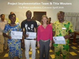
NOEVA team of 3 Beninese young scientists, supported by IRD France and UAC
Period
July 2017 – April 2019
Location
Cotonou, BeninCotonou,
Last project updates
Background
**Cotonou is the economic capital and the largest coastal city of Benin**: it is known throughout West Africa for its commercial port, its 20-hectares international market (Dantokpa) and its Zemidjans (motorcycle taxis). Cotonou urban is about 680,000 inhabitants to which must be added the suburban population of Abomey-Calavi (656,000) and Sèmè-Kpodji. Today, the population of Benin is about 10 millions, meaning that about 15% of the Beninese are living in the Greater-Cotonou (i.e. urban and suburban). At national level, the growth rate of urban population is significantly higher than the growth rate in rural Benin (i.e. 4.8% and 2.6% respectively). However, the growth rate of Cotonou urban will probably be slower because the city is already almost saturated as indicated by its low increase rate of only 2% between 2002 and 2013. However, **the suburban areas will undoubtedly continue to increase since the population of both Abomey-Calavi and Sèmè-Kpodji has already doubled during the last 10 years**.
Project Plan
NOEVA intends to investigate both the technical capability of geophysics in coastal urban context, and the cost effectiveness of geophysics in West Africa environment. This will be done by **(1) carrying out geophysical measurement** (i.e. Magnetic Resonance and Time Domain EM soundings) during the first half-year of 2018, **(2) reinforcing the hydro-meteo monitoring of the aquifer** (i.e. rainfall, water level fluctuation, etc.) during the full year of 2018, and **(3) comparing the geophysical and hydrological data** (during the second half-year of 2018) to assess the technical and economic interests of the use of geophysics and to estimate groundwater storage and recharge. The entire activities will be carry out by the Project Implementation Team (i.e. the 3 young Beninese scientists) supported by senior scientists (i.e. the Project Steering Comity).
Target group
**The direct targets of the project will be three young African scientists** who will be in charge of the Project Implementation. Indeed, we want the skills to be African because only local capabilities can reach to a sustainable management of the water resources. In the past, many studies have been carried by foreign experts and we now want to secure a young generation of Beninese scientists to work for their country. **At the end of the project, the direct beneficiaries will be the actors (both institutional and private) involved in the groundwater supply and management of the Greater-Cotonou**. The ultimate beneficiaries of NOEVA will be the inhabitants of the Greater-Cotonou (i.e. about 1.5 million of people).
Sustainability
**NOEVA aims at developing the capacities of local scientists** (and not foreign consulting firms) to management the water resource used to supply the Greater-Cotonou. Indeed, water management is a continuous process which involves a regular analysis of monitored parameters such as groundwater level and quality, rainfall, etc., and a regular update of the numerical model based on new data, new scenario of pumping to cope with new demands, or new scenario of groundwater recharge driven by change in rainfall or land use, etc. **NOEVA outputs will be shared and freely available**. We will pay a special care to the dissemination of the knowledge developed by NOEVA. We will organize with the support of a knowledge broker two workshops to disseminate the lessons learned and the NOEVA results to both the public and private actors involved in coastal groundwater resources in Benin. All of the consolidated data (rainfall, water level, geophysics) will be made available in the SNI-EAU (Système National d'Information sur l'Eau du Bénin) which is an open source platform to share map and data related to water in Benin. Moreover, NOEVA data and results will also be used as course material for MSc and engineer students of Abomey-Calavi University.
Overview of Goals
The main technical objectives are **(1) to develop a technical and cost effective approach to improve the knowledge of the groundwater resource** which supplies the Greater-Cotonou, and **(2) to use this approach to improve the quantification of the groundwater reserve (i.e. the storage) and its renewability (i.e. the recharge)**.
Results and indicators
- Geophysical measurements are carried out and interpreted.
- 5 geophysical loggings
- hydro-meteo monitoring is carried out
- 5 rainfall chronicles
- 9 SWL chronicles
- 5 Groundwater EC chronicles
- A geophysical approach is developped
- Economical analysis
- Technical comparison
- Groundwater reserve and recharge are estimated
- Quantification of groundwater reserve
- Groundwater reserve (mm) are estimated at 5 locations
- Quantification of groundwater recharge
- Quantification of groundwater recharge are produced at 5 locations
- Data are made available
- Local capacity building
- Two learning workshops are organized
- The knowledge of the 3 members of the PIT are reinforced
- Training course at ITC
- A member of PIT attends a course at Twente University (6 weeks)